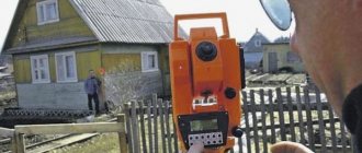
Land surveying is necessary in order to determine and assign to the owner of the plot its boundaries and establish its area. Land surveying is carried out by employees of a geodetic company, who come to the site and, using special instruments, determine the boundaries of the site and draw up a special act. After this, a boundary plan is drawn up. AiF.ru found out why land surveying is necessary from the head of the Land Surveying, Cadastre, Registration practice and member of the Commonwealth of Land Lawyers Yulia Buzanova .
Questions and Answers How can I find out if land surveying has been carried out?
What is land surveying and why is it needed?
Land surveying is a procedure for officially establishing the boundaries of a land plot , which is carried out by:
- planning;
- topographic survey;
- drawing boundaries into reality;
- registration of cadastral documentation.
Planning is carried out as drawing up a preliminary project for geodetic survey of the site and determination of boundaries. Geodetic survey is the determination of the area of a site on the ground, with the establishment of boundary markers at turning points. After it has been carried out, based on the measurements received, a boundary plan is drawn up (see also types of boundary plans) and other reporting documentation required for registration.
You can find out more about the stages of cadastral work in this article. We also recommend that you find out initially how much land surveying costs.
Causes
Restoring the boundaries of the site, removing them, clarifying or allocating a share in kind may be necessary in certain cases. For example, a plot should be registered in the cadastral register if it is not in the information bank of the State Real Estate Cadastre (GKN). These provisions are defined in the Federal Law of July 24, 2007, No. 221-FZ.
If land plots are being reorganized , land surveying is also indispensable. Which complies with the requirements of the Federal Law of July 27, 1997, No. 122-FZ. When constructing a permanent structure and reconstructing it, you will need a building permit, which is carried out on the basis of the preliminary survey carried out:
- SPOSU;
- GPZU (instructions for filling out are described here);
- SPZU (may be needed for gasification, for electrical networks).
These provisions are approved by the Town Planning Code of the Russian Federation. These and similar reasons require proper documentation for the site.
When privatizing land plots , in accordance with the provisions of the “dacha amnesty”, this procedure was canceled, in accordance with the provisions of the Law on Privatization No. 1541-1 of July 4, 1991. Property transactions also do not provide for mandatory land surveying.
Is the consent of neighbors required when surveying?
Another important reason requiring land surveying is disputes with neighbors over the location of boundary boundaries and compliance with setbacks, in accordance with the red line standards. In this case, the consent of neighbors is not required for land surveying. However, by a court decision, a request for it may be made.
Upon completion of geodetic work, it is necessary to draw up an act of coordination of boundaries with neighbors. The act is usually drawn up on the reverse side of the boundary plan. It is compiled by a cadastral engineer, according to the regulations - he also signs it with the neighbors. If neighbors refuse the certificate, it is allowed :
- Sending by registered mail a notification about the need to coordinate boundary boundaries. Attachment of documentation confirming the sending of this letter to the approval act.
- Filing a claim in court to require the signing of the act.
Is it necessary to survey a plot of land when selling?
Because Land purchase and sale transactions occur very often these days; it is worth clarifying whether land surveying is necessary when selling a plot of land.
The requirement of Rosreestr when registering a property purchase and sale transaction is not subject to the obligation to survey land plots. That is, in order to sell a plot, the seller is not obliged to conduct it. This procedure is primarily needed by the buyer. It is in his interests that precise boundaries of the allotment be established.
When buying land without established boundaries , he will assume the need to carry out the procedure. And during its implementation, problems may arise such as the imposition of boundaries or their displacement, which will lead to corresponding legal consequences, including legal disputes.
Land surveying process
Let's briefly look at the land surveying process itself and its main stages:
- Collect detailed information regarding the area of interest to you. This requires initial coordinates, as well as information about neighbors and the history of changes in ownership.
- Drawing up a complete and detailed project according to which the area will be studied. This project is always done in the form of a diagram, and the boundaries of the land plot are drawn on it.
- Drawing up an act. This event involves the participation of all persons whose interests will be affected in the process. As a result, when drawing up the act, boundaries must be indicated, which will be recorded by the cadastral engineer in all documents.
- Carrying out a survey of a geodetic nature, which will allow you to accurately determine the coordinates of the site and calculate its area.
- Drawing up a real estate diagram. In this process, you should not forget even about those nuances that seem insignificant to you.
- Registration of the land survey itself. At this stage, absolutely all the papers that have been compiled from the very beginning of the research will be collected.
Upon completion of all this work, the survey file will be sent to the Rosreestr department, special cadastral documents will be drawn up there, after which they will be issued to the owner of the land plot.
Is it necessary?
Is it necessary to survey a plot of land?
As practice shows, land surveying is required. Therefore, we recommend reading our surveying instructions.
There is no alternative to this procedure. The question of carrying out land surveying of a dacha plot can only depend on the time frame determined by the owner of the land plot. Sometimes contacting a geodetic company occurs after the fact, when a particular problem is brewing and requires a solution. Conscientious rights holders of land plots, as a rule, prepare documentation for land surveying in advance.
Why is mandatory land surveying introduced?
Legislators expect that precise definition of boundaries will significantly reduce the number of land disputes between neighbors in the future. This will significantly reduce the burden on the courts.
Also, with the introduction of new rules, the life of unscrupulous sellers will become seriously more difficult. They will no longer be able to mislead buyers by indicating a plot area different from the real one. The buyer will only need to request a certificate from the State Property Committee in order to get a complete picture of the properties of the land.
Why is land surveying necessary?
The most common among them:
- Cutting a section or allotment , with the removal (restoration) of boundaries in nature.
- The merger of two or more plots into one and the division of one plot into two or more.
- Registration of extensions at the expense of adjacent abandoned lands.
- Preparation of documentation on land plots for a property transaction.
- Preparation of documentation for a land plot not registered in the cadastral register, with registration.
- Preparing the site for construction work , electrification and gasification of the charger.
- Boundary disputes with neighbors.
Why is land surveying necessary besides the above reasons?
In addition to the fact that drawing up a plan for the location of the site, indicating the boundaries and transferring this information to the State Committee for Property Management is a mandatory procedure, the advantage of land surveying has another significant aspect. In any current situation, the cadastral engineer provides consulting and other support . And if legal disputes arise, he acts in court on the customer’s side.
Why was the vaccine made so quickly?
Scientists at the Gamaleya Research Center had a good start: previously, on the same platform, they created a vaccine against the Ebola virus (it received WHO approval and is successfully used in African countries), and then a vaccine against the MERS virus, which causes Middle East respiratory syndrome. It took only two weeks to design the vaccine, and preclinical experiments on animals began in February-March.
How was the new vaccine tested for safety and effectiveness?
The vaccine was first tested on rats, ferrets, and monkeys, and the health of vaccinated animals that were infected with SARS-CoV-2 after vaccination continues to be closely monitored to this day.
In the summer, tests were carried out on 86 healthy volunteers, all participants were under 60. There were no serious side effects after vaccination: signs characteristic of other vaccinations were noted - a feeling of cold, itching at the injection site, fever. The scientists themselves, including Ginzburg, also injected themselves with their drug.
At the same time, there is another wider testing ahead, in which two thousand doctors and teachers will take part.
According to the creators of the vaccine, its protective effect will last for two years after vaccination. Photo: RDIF and Gamaleya Center / TASS
Is it necessary to do land surveying if the plot is registered in the cadastral register?
If the lands are registered in cadastral records, this legal position does not cancel land surveying, because the lands were most likely registered at the time the plot was allocated to the legal holder. During this time, changes in the configuration of the site or unauthorized redistribution of boundaries by the previous owners could have occurred.
The site parameters should reflect only current information . Otherwise, incorrectly entered information will cause a cadastral error. Subsequently, when registering land ownership, due to discrepancies in information, difficulties may arise and refusal of the registration procedure initiated by Rosreestr.
Question from Maria from Nizhny Novgorod: Is land surveying necessary if you have a cadastral passport? Answer: This precedent is possible even if you have a cadastral passport. Since when issuing a cadastral passport, those parameters of the land register that were entered into the information bank were taken into account, they may not correspond to the real state of affairs.
Do I need to get two vaccinations: against COVID-19 and flu?
The Ministry of Health says: yes, it is necessary. But until now, scientists have not answered the question: is it possible to become infected with both influenza and coronavirus at once, and how severe will COVID-19 be in this case? The flu, by the way, is not at all harmless: up to 650 thousand people die from it every year in the world. Let us remind you that according to the latest data, more than 740 thousand have already become victims of COVID-19. Therefore, by getting a flu shot, you can reduce the risk of serious complications if you become infected with coronavirus. Immunologists say that there is nothing dangerous in complex vaccination, if carried out correctly. The Ministry of Health recommends that people from risk groups get another vaccination - against pneumococcus. This will reduce the risk of such a serious complication of influenza as the development of pneumonia against the background of an associated bacterial infection.
Is land surveying necessary if the land is owned?
When registering ownership, discrepancies between the actual parameters of the property and the records of the State Property Committee may also not have been taken into account. Unspecified information may cause the termination of a property transaction or refusal to establish an encumbrance with an easement, pledge, etc. That is, a discrepancy identified during the process of registering a property transaction or registering an inheritance may cause the suspension or termination of the registration procedure.
In addition, when carrying out construction work on a site, as well as when installing gas, electricity and other communications, a geodetic survey will be required in any case, to draw up a situational plan or obtain a building permit.
The absence of a boundary plan may become an obstacle to a property transaction or other types of work. It is advisable to compile it in advance and carry out land surveying.
How might the body react?
Whether adults or children should be vaccinated is one question, but parents should know what to expect after vaccination.
Acceptable reactions include the following:
Such symptoms are most often observed in the first two days after vaccination. Children have the hardest time tolerating the complex vaccine, so whether it is necessary to get the DTP vaccine at this time should be discussed with a doctor. When a fever appears, the child should be given an antipyretic drug: Nurofen, or a Tsefekon suppository can be placed.
If a local allergic reaction occurs in the form of redness or swelling, give the baby Zyrtec or Fenistil.


