Land surveying in SNT is necessary not only in order to know your boundaries, but also to avoid disputes with neighbors, as well as in order to prepare the necessary documentation for the land. This seemingly simple procedure has a number of features. New trends in land legislation, in particular the adoption of Law 217-FZ “On Horticulture and Horticulture,” which came into force on January 1, 2020, have made adjustments to the land surveying procedure. We will examine in more detail what features of land surveying in SNT are fixed in 2020.
What is this
Land surveying is a set of geodetic measures that help describe the boundaries of property, as well as topographic and cartographic features. The process involves measuring the boundaries, as well as the total area of the site, using geodetic equipment. As soon as the work is completed, specific information will be reflected in legal papers.
There are a number of reasons when land surveying is required:
- A land deal needs to be completed. We are talking about buying and selling, exchanging, donating and making a will.
- Situations when you need to confirm your rights to a plot.
- The need arises to divide or unite the land.
- The plot has a high market value.
- The owner wants to reduce the payment of taxes or rent by specifying the area of the plot.
- Correction of cadastral errors, as well as resolution of disputes with neighbors regarding boundaries.
However, in a gardening partnership the situation is slightly different.
Its peculiarity is that the land has a specific owner, but it is part of the whole complex. Therefore, it is not always clear who exactly may express a desire to define the boundaries, the owner or the managers of SNT. If we look at the law, we can conclude that the partnership is not the collective owner of the plots. Therefore, the authorities do not have the right to independently begin land surveying, because they are not considered the owner of all the land. But at the same time, gardeners can jointly decide that it would be easier to organize the procedure for everyone at once. Then you can instruct the management of SNT to deal with the process, because it was created for such events.
Important! Carrying out land surveying in SNT is not a mandatory procedure. But it is recommended to complete it in order to be able to carry out real estate transactions.
A person can decide for himself whether it is necessary to do land surveying for his plot. He has the right to single-handedly engage in the procedure for determining boundaries or, conversely, to refuse it. But it is worth remembering that until the land survey is done, it will not be possible to sell, bequeath or donate. This legislative rule will come into effect at the beginning of 2020.
Is the signature of the chairman of the council required when surveying a site?
This procedure is a set of works during which the boundaries of the site are established (or restored) and fixed on the ground, its exact area is determined, and the results obtained during the study are formalized in the form of a boundary plan .
Even if the owner of the plot has never seen the owners of other plots and does not know whose land is located in the adjacent territory, they need to be found, because It is required to collect signatures from neighbors . If contact between the landowners of the garden association never took place, you need to send a letter via postal service.
Advantages and disadvantages
Before asking yourself how to survey a plot of land, it is worth considering the positive and negative aspects of this procedure.
As you know, according to the rules, no one can force a person to start this process. Therefore, now such a decision is made voluntarily, if necessary. There are certain disadvantages due to which people refuse the procedure and postpone it until later. The advantages include:
- The boundaries of the land plot are displayed in documents. At the same time, neighbors must confirm that they agree with the established boundaries. This means that in the future they will not be able to start an argument over where exactly their plot ends.
- The procedure is carried out free of charge from the municipality. Therefore, people don't have to worry about paying large sums of money to set boundaries.
- It becomes possible to carry out various transactions, including donation, inheritance, purchase and sale and rental. As already mentioned, from 2020, such an opportunity will disappear for dacha lands if they have not been surveyed.
Disadvantages also exist, and first of all, people are not satisfied with the fact that they will have to spend time and effort on the procedure. On average, this will take one and a half months, although the period may vary depending on the situation. However, the process will still have to be carried out one day, so you should not postpone it until the last minute, so as not to experience inconvenience in the future.
People are also concerned about the fact that legislation changes quite often. Therefore, owners of gardening plots decide to wait longer. Moreover, municipal specialists are not always competent enough, which also leads to difficulties.
Based on this, it is worth deciding whether land surveying is necessary for the dacha. Experts recommend that you still carry out this procedure, because it eliminates many inconveniences and allows you to avoid conflicts with neighbors. It will be useful for people who decide to start the process to know its sequence and the necessary measures.
Documents for land surveying in SNT: a complete list with samples of the project and protocol
- It is necessary to obtain a decision from the local administration to prepare a land survey project (LMP). It is published on the administration website and in official periodicals.
- Within a month, any resident of the municipality can make a proposal on the published project.
- The actual development of the land surveying project itself will take about a month.
- Approval of the project by the general meeting of SNT members.
- It will also take about a month to coordinate the project with authorized government agencies and municipal authorities.
- Approval of the project by the head of the local administration or rural settlement (30-day period).
- passport data of all neighbors and other interested parties;
- outcome of the agreement;
- the resulting diagram of the boundaries of the land plot with coordinate data;
- if so, then the objections of interested citizens;
- signatures of those present at the meeting and the engineer himself with his seal.
About public lands
A garden partnership includes not only people’s plots, but also a PDO. This abbreviation can be deciphered as public lands, which include specific territories. These are roads, parking lots for technical equipment, utility rooms, ponds and passages. That is, the public lands of the SNT are an obligatory part, which cannot be dispensed with.
Not everyone considers whether their boundaries need to be defined. According to the law, land surveying of public lands is a mandatory procedure that every partnership must carry out. The process itself is similar to that carried out for plots owned by people. However, the main difference is that the responsibility falls not on the owner of the site, but on the board of SNT. It is they who should think about starting the process.
It will be necessary to convene a meeting of shareholders, where the issue of land surveying will be raised. People will need to make a decision about starting the procedure, and then start collecting contributions. Although the process is not easy, without it the state has the right to cancel the garden partnership.
Summing up, we can come to the conclusion that, although it is not necessary to survey your site, it is very desirable. In the future, many problems, especially related to transactions, can be avoided. That is why the sooner the boundaries are identified and the property is registered in the real estate registry, the better it will be for the owner. The same can be said about public lands, only in their case this procedure is mandatory.
Land surveying in SNT: necessary documents
The bulk of the difficulties are associated with disagreement between neighbors regarding the distribution of the plot. As a rule, the owners of neighboring plots are sure that they have been deprived. According to the requirements of the law, the reluctance of third parties to approve the protocol of calculations and division of plots is not a basis for refusal to formalize a land surveying project. But this fact must be reflected in all required documents.
The second step, after the papers have been prepared, is a meeting of the neighbors with whom the plot borders. This is done in order to notify about the upcoming procedure, as well as to agree on the boundaries. If the dispute cannot be resolved peacefully, you will have to go to court to protect your interests.
What documents are needed for land surveying in SNT in
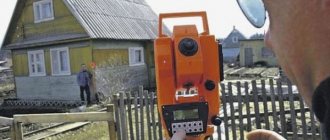
First, the necessary data is collected and analyzed. Next comes notification of citizens whose rights may be affected during land surveying. A specialist from an authorized organization goes to the site. Using special instruments, he takes measurements of the territory. For clarity, pegs are inserted into the ground to indicate the boundaries of the site. An act of surveying the boundaries of the land plot is drawn up. signed by the owners of the plot and neighbors, the engineer who is carrying out the work Draw up a boundary plan At the appointed time, the owner of the land plot can pick it up from the company that carries out the survey Submit documents and the boundary plan to the government agency To obtain a cadastral passport
This is interesting: Benefits for labor veterans in the Tyumen region in 2020
Plots are accepted for registration with the Rosreestr authorities without surveying and coordination of boundaries. A case is drawn up only in cases where there is a dispute or difficulties in establishing them. In other cases, it is enough to provide a cadastral passport or an extract from the cadastre.
Is it necessary to do this if you have a gardening book?
Do I need to survey my garden plot if I have a gardening book? It depends on the situation. From the point of view of the law, no one can oblige the landowner to carry out this procedure without reason.
It is planned to separate from the common property, sell, or some other legal action - this is all for which land surveying of the garden plot is necessary. The gardening book does not contain such data that can be obtained exclusively from land surveying.
Read more: State housing certificate for military personnel
Is it necessary to carry out land surveying of a garden plot if there is a cadastral passport? At the moment, even a cadastral passport is not such a universal document that allows you to avoid this procedure.
Although increasingly, when requesting a cadastral passport, a requirement is made for land surveying. Starting from 2020, it will take a single form, which will contain:
- number;
- type of allotment;
- dividing lines, turning points;
- geographical coordinates;
- description of the site;
- number of square meters;
- grounds for registration as private property;
- information about encumbrances.
But this is in the future. At the moment, even many cadastral passports do not contain data on the boundaries and turning points of the site.
After the documents have been verified, they will be returned to the owner and a certificate of ownership of the land will be added to them.
Documents for land surveying
As mentioned above, land surveying is carried out by a special organization or person who has the appropriate license for this activity. The customer has the right to choose a specialist at his own discretion. You can contact the Technical Inventory Bureau or consult with those who have already had experience in this matter.
- Last names with initials of all persons interested in this issue.
- Details of passports or other identification documents.
- Results of coordination (joint or individual).
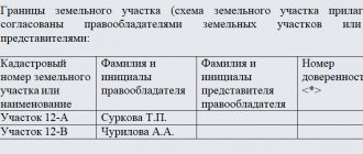
- The final diagram of the boundaries of the site indicating the coordinates.
- Objections from interested parties (if any).
- Seal and signature of the engineer who carried out the survey.
- Signatures of neighbors who expressed consent.
This is interesting: Do Bailiffs Have the Right to Withhold Money 50% If the Balance Is Below the Living Wage


