Geodetic work on the site - determining the parameters of the site for construction work
Details Created 08/31/2014 12:06
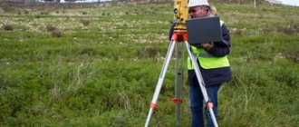
In order for the geometric parameters of the objects under construction to comply with building codes, geodetic work is mandatory during preparation for construction. One of the main types of geodetic work is survey work. This type of work is carried out in the period preceding design.
As a result of the survey, models are built: graphic in the form of a topographic plan (topographic map), as well as analytical in the form of a digital map. In addition to survey work, surveyors carry out tracing, alignment work, executive surveys, as well as observations of object deformations.
Types of filming
- Topographical – used to create a digital model of the site, for planning vertical buildings and designing landscape design. The heights of some points over others, the distance between them, angles are measured, the sizes of buildings, above-ground and underground networks, streets with roads and sidewalks, and green spaces are noted.
- Executive – a set of surveys aimed at comparing actual data on an object with initial information. Surveying is carried out at the time of delivery of the finished object, but this service can also be ordered during the construction process to detect violations of building codes.
- Facade – photography of the external surface of a building to determine the coordinates of the structure, the dimensions of the facade of the structure as a whole and its individual parts. Photography is in demand during the construction and reconstruction of structures, when determining the size and area of buildings, when drawing up estimates for the restoration of houses of historical significance, and when conducting construction expertise.
- Vertical - leveling, used in geodesy when considering terrain features, studies the excess of some points over others and identifying the same heights. Based on the results, the maximum and minimum height of the site, slope, and isolines with identical elevation data are determined. Vertical surveying is necessary to identify the place on the site where the building will be most stable, as well as to clarify the slope angle of the sewer or water supply route.
- Horizontal - for tracing the contours of buildings, longitudinal sections or non-standard shapes.
Price
from 12,000 rubles
Order
Geodesy of the land plot
The process begins with an analysis of the terrain in the selected area. A visual inspection creates a first impression of the relief and landscape for making a decision, choosing the most successful location for a future building or marking a land plot.
The most crucial moment before the start of construction is carrying out marking work. The project is transferred to nature according to the coordinates indicated in the project. The geometry of the model is created by transferring the main, main and intermediate axes, which allows you to determine the position of the building on the site. Drawing up a layout drawing on a scale of 1:500-1:2000 - documentary evidence of the research carried out.
Geodesy of a land plot depends on the goals of implementation and involves the following engineering studies: creation of reference geodetic and plan-elevation networks, analysis of topographic surveys, search for underground communications.
At the first stage in applied geodesy, topographic surveys are carried out to assess elevation levels, terrain slopes, including the presence of trees and reservoirs. Topographic surveys are carried out at a scale of 1:100, 1:200, 1:500, 1:1000, 1:2000 or as specified in the task. The choice of indicators depends on the complexity of the terrain.
Conducting geodetic research is necessary in the following cases:
- designing highways (general and express roads);
- design work for the construction of residential buildings and engineering structures;
- surveying a plot of land or land management work;
- construction activities for industrial buildings and production facilities;
- search for utilities (water supply, sewerage, electrical networks) with application to the topographic plan;
- geodetic support of works of any purpose;
- shooting of building facades;
- preparing buildings for reconstruction or major repairs.
Additionally, a tree survey may be required. All received materials subsequently become the basis for topographic plans with the drawing of above-ground and underground structures, geo-base and diagrams of the land.
The next type of work is land management. It is necessary to carry out a procedure for surveying land resources in order to determine the boundaries of plots and then put them in nature. Based on the act with signatures of the owner of the site and neighbors of adjacent lands, confirmed data from Rosreestr, a boundary plan is drawn up.
Stages of work
- Preparatory. Collection of archival data about the land plot, review of technical specifications and documents submitted by the client. Development and coordination, approval of the work plan.
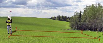
- Field. Before starting filming work, specialists carry out the following actions:
- A theodolite traverse is laid from the nearest points marked with benchmarks to a plot of land. If your work uses GPS equipment, then this step is skipped.
- One or more places on the site are selected from which the surveyor can observe the maximum number of desired points and carry out surveys. If there are several stations, then they should visually communicate with each other.
- By means of laser or optical centering, a total station or other device is installed, located directly above the station.
- An outline is drawn up - a visual diagram of the allotment, on which all existing objects and their characteristics are indicated on a certain scale. During the measurement work, the surveyor usually makes corrections.
- A geodetic survey of the land plot is carried out, as well as additional measurements - lines that were not visible from the station, underground communications, heights of buildings and green spaces.
- Cameral. Reviewing the results of field work, drawing plans, diagrams, projects, etc.
How much an engineering and geodetic survey of a site will cost depends on the type, complexity and urgency of the work, the location and area of the site, and the type of object.
will carry out professional geodesy of sites in Moscow and the Moscow region in a short time, at a high level of quality and at competitive prices. You can order a full range of work or individual services from us. You can ask any questions, find out the cost, or submit an application by phone.
Stages of topographic survey of highways
The main provisions that relate to the design and construction of road lines are set out in SNiP 11-02-96. According to regulatory documents, topographic survey is a mandatory stage, which is subject to control and coordination of the results with other operating organizations.
Topographical survey of the road section is carried out using electronic total stations in three stages.
- Stage one is collecting the necessary information about the area where it is planned to conduct geodetic research for the design, reconstruction or construction of a new road, as well as determining the technical specifications.
- The second stage is performing work directly on site. Geodetic measurements of the corners and sides of the route are carried out. Surveyors set up the picket line, secure the route and carry out leveling. In addition to these works, additional surveys are taken of crossings of other roads and places where the terrain has a complex shape.
- The third stage is the implementation of desk processing of the existing survey results. The collected information and measurements are processed and compiled into a final topographical plan.
Based on the collected data, a topographic map of the road and the surrounding area is obtained, as well as other information that is necessary for drawing up the project (longitudinal and transverse profiles, coordinate catalogs).
Specialists
have in their arsenal geodetic equipment that meets technical norms and standards in terms of obtaining guaranteed accurate results of topographic survey of roads. Survey data is used to compile a geological basis for land plots, taking into account existing buildings and facilities in Moscow, the Moscow region and other constituent entities of the Russian Federation where construction is planned. The topographic plan is prepared for the customer both in paper form and recorded on electronic media.
Video – Engineering-geological surveys, geodetic works
Recommended viewing:
- Cadastral passport of a land plot - a necessary document for transactions - 09/16/2014 09:41
- Autonomous sewage system at home - comfortable conditions in the house and protection of the natural environment - 12/09/2014 09:53
- Construction of a porch of a wooden house - design of the front entrance - 02/09/2014 07:07
Related topics:
- Insulating the foundation of a wooden house is a reliable barrier to heat leaks - 08/28/2014 06:50
- Carrying out land surveying - determining the exact boundaries - 08/27/2014 11:47
- Interior decoration of a wooden house - materials for implementing design ideas - 08/26/2014 07:18
Geodetic work in construction
The main type of geodetic work is topographic survey. Thanks to this process, you can obtain a topographic plan or map. The plan will contain information about absolutely all objects, be it buildings with structures, trees with utility lines. This also includes the terrain. Shooting of this type can vary in scale and type. The preparatory part, field and office stages are components of topographic survey.
If the boundary sign was lost or was not installed at all, then an effective solution to the problem would be to remove the boundaries of the land plot. This type of geodetic work allows you to effectively restore the real boundaries of a plot of land on the ground. Land surveying allows you to determine the boundaries of plots in the horizontal plane. The method is relevant if someone has acquired a plot without established boundaries. High-precision equipment and work with documents will help in solving this problem. The method is good for resolving many disputes between land owners and the state. A boundary mark can be either temporary or durable. The first involves securing dowels, metal pins, and stakes to the area. The second option requires laying metal pipes or pillars to the appropriate depth.
Since construction and installation activities can be carried out on the site, executive geodetic survey is used. This method is based on determining the accuracy of the project being carried out and possible deviations. A special feature of the method is its use both at the beginning of work on the site and throughout the entire process.
Goals of geodesy
With the help of surveyors, builders solve a number of problems:
- Choosing the optimal location for construction. With the help of geodesy, the composition and structure of the rock is determined, the relief of the construction area is studied;
- Connection of all existing structures with the constructed object into a single system. This is done to ensure the possibility of centralized operation of the entire complex and increase the comfort of people living (working) in the complex. This can only be achieved by properly linking the object being built to existing ones.
- Formation of a topographic map performed to fix the boundaries of the construction site. The map includes the locations of all structures, buildings, communications present within the boundaries of the object, as well as the topography of the construction area;
- With the help of geodetic surveys, it is possible to track the progress of any changes in the earth's crust. This will help during the construction process to take measures to preserve the building, for example, in the event of an earthquake.
Office stage
The essence of the stage is the final preparation of documentation.
Depending on the tasks assigned, this may be a land management plan or a plan for the boundaries of an allotment or settlement.
The plot plan map is drawn up on one landscape sheet. The plan of a larger territory can be placed on several sheets, and the general plan diagram must be indicated and numbered.
The plan has graphic and descriptive parts.
The descriptive part contains information about the site obtained during the land surveying procedure, data about buildings, structures, and unfinished objects.
A graphic image is a drawing of a summer cottage with geodetic signs on it.
Mandatory data are:
- cadastral number of the object;
- boundaries and relative positions of boundary signs;
- dimensions of the territory (area, directional angles);
- description of neighboring boundaries;
- coordinate network outputs;
- north direction indication;
- scale.
The plan map in electronic form is endorsed by the signature of the executing specialist and entered into the Unified State Register of Real Estate.
All documentation generated based on the results of the work is subject to inclusion in the land management file, which compiles the information in the following sequence:
- introductory part, which consists of a title page, a table of contents and an explanatory note about the tasks and essence of the work performed;
- information about the allotment in the form of a cadastral plan, which is available in the Rosreestr of Real Estate;
- the task assigned to specialists in the field of geodesy;
- copies of title documents for the allotment;
- technical project;
- information regarding the approval of the site and related documentation (for example, data on calls from neighbors);
- powers of attorney;
- list of coordinates of boundary markers;
- a plan map indicating the boundaries of an object.
This documentation is entered into a special data fund, which is formed from land management files, being the property of the Russian Federation. State bodies have the right to exercise control over land surveying work. It is carried out to identify possible non-compliance with legal requirements.
The objects of control are documents of both the field and office stages. As a result of the inspection, an act is drawn up, which is also subject to inclusion in the land management file.
Violation of established requirements may result in the prosecution of the guilty parties.
The last stage is documenting the data obtained during the survey.
All information is entered into the land survey file and can be checked to ensure compliance with technical and legal requirements.