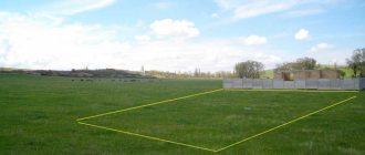
Definition of grading and quality
To fully understand the topic, it is necessary to determine the value of quality as part of a qualitative assessment of soils. Bonitet is a term that defines the ability of a particular object to satisfy predetermined conditions. By assessing the value of quality, one can describe the quality of a business entity, the creditworthiness of a company or client, the quality of goods in a company from a technological and economic point of view. Land can be valued, whether for agricultural services or land development, to determine its quality.
Valuation is the determination of the productive, breeding qualities of animals by assessing them according to a set of characteristics. There is also grading of livestock, which represents a comprehensive assessment of each animal taking into account milk production, exterior, constitution and origin. Land valuation has a similar meaning, only it is not animals or their productivity that are assessed, but the quality of the soil layer and its suitability for growing crops.
Main types of land valuation
We must not forget that the legal system of a particular country may differ significantly. Since the types of land valuation are determined by law, they may differ in different countries. Despite this, the following types of valuation manipulations with land can be distinguished.
- Monetary valuation of land. It is carried out when there is a need for economic regulation of land relations during the conclusion of civil agreements, in other words, it is carried out to determine the exact value of a specific land plot. This type of assessment is also prescribed when determining the land tax rate.
- Economic assessment of land. This manipulation is carried out to collect data that will later become the basis for conducting a normative monetary valuation of land, determining the economic suitability of agricultural land for growing crops, and analyzing the efficiency of using the site in comparison with other natural resources.
- Soil grading. It involves collecting data that will subsequently become an integral part of the state land cadastre and the basis for the economic assessment of agricultural land. Also, thanks to soil grading, the environmental suitability of the soil for growing agricultural crops and forestry production is determined.
These approaches to assessing land plots are fundamental and allow us to determine the most significant factors and comprehensively study the degree of suitability of acres.
Goals of Soil Assessment
An assessment of the soil layer is prescribed to solve the following problems:
- Compare and also group according to specific soil characteristics in different regions, republics, and regions.
- Identify the best plots of land on which it is planned to grow the future crop.
- The condition of the soil layer at the moment is assessed, after many varieties of food have been grown on it for several years.
- Identify remaining reserves.
Experts also give advice on carrying out activities to improve the overall situation, voice ways to solve the problem of crop failure, and explain the reasons for its occurrence. These are bonuses to the main task - improving existing farming methods and trying new ones.
The essence of land valuation
Market valuation of land plots involves determining their value or the value of the right to lease them. First of all, the decisive factors in the assessment are:
- location;
- favorable external factors;
- supply and demand in the relevant market;
- equivalent utility compared to another site.
Also during the assessment, the possibilities of connecting to communications in the case of building a house, their qualitative and quantitative composition, are taken into account. In addition, integral components of any site assessment are such indicators as engineering-geological and engineering-geodetic surveys. They help determine the composition of the soil, its condition, general properties and characteristics of the relief of a certain area. All these indicators are extremely important if construction or agricultural work is planned on the site in the future, that is, in most cases.
It is worth noting that market, or in other words, cadastral valuation of land plots is important not only for the land owner, but also for the state. The importance of the assessment process is determined largely by two indicators.
- Thanks to valuation manipulations, it is possible to determine the value of land as part of natural resources and the value of individual plots.
- Without assessing the land, it is impossible to determine the real price for it. That is, a person who decides to sell a plot will not be able to do this, simply because he will not be sure of what amount to demand for it.
Main evaluation criteria
Soil is a complex mixture of minerals, water, air, organic matter and many decaying organisms, living things. When assessing soils, specialists rely on criteria such as diagnostic features. This phrase refers to a number of criteria, the assessment of which helps to derive the final result. The mechanical composition of the soil layer, the degree of cultivation, salinity, acidity are checked, and other important criteria are assessed. Not all diagnostic signs are suitable under the strict gaze of experts, but only those that correlate with yield.
Existing valuation methods
When grading, one of the most difficult is the process of determining crop yields. This problem arises due to the fact that the existing system of accounting and reporting of enterprises provides data on the productivity of the entire farm, but the soil cover is not identical everywhere.
Soil layer grading was practiced back in ancient Rus'. This can be judged from old chronicles. Later, under Ivan the Terrible, a law was even introduced approving verification of the quality of land plots.
There are several methods for assessing land. Let's look at Blagovidov's method first.
The scientist believed that the soil layer depends on the territory and the properties inherent in it; based on these qualities, one can judge the productivity. This scientist introduced a scale, following which each type of soil layer can be assessed from 1 to 100. In order to determine the score, N.L. Blagovidov compiled rating tables for soil layers of different mechanical composition. For each type of soil layer, its own table with a scale was given, after which a qualitative comparison was carried out and the results were displayed.
Method of the Soil Institute named after. V.V. Dokuchaev is intended for assessing soil for grain crops. The topsoil layer is examined. This method also takes into account various tables. Many scientists introduced their own methods (Sobolev, Tyumentsevsky, Burlakovsky). It is difficult to judge which method is the best, since each contains an evidence base and tables.
Who can become the subject of assessment activities?
Evaluating something presupposes the existence of objects and subjects being evaluated. The second are appraisers and persons who “provide” the site. The assessment of acres is traditionally carried out by the following representatives:
- individuals. They are practicing business entities who have the appropriate document (appraiser certificate and license) and have been trained in this direction;
- legal entities. These are business entities, regardless of their organizational and legal form, who have received a license to carry out land management work;
- other types of legal entities. They are business entities, regardless of their legal form and form of ownership, who have appraisers for monetary expert valuation of land with a license to perform this type of work in accordance with the law;
- bodies of executive power and local self-government, but on the condition that they carry out management in the field of land assessment.
These are the four main “representatives” that have the right to evaluate land. All subjects are specially trained to carry out assessment manipulations with the earth and do this in a special way. If you need an appraisal of a house or land, contact only professionals, otherwise you risk costing a pretty penny.
Stages of land assessment
When conducting assessment activities, the following stages are distinguished:
- Identification and initial assessment of the object.
- Analysis of documents confirming the owner’s rights, other technical documentation.
- Processing of all data on the soil of lands in a particular region, developing a rating scale and determining the quality score of the soil layer.
- Conducting market value assessments, advice on site improvement and fertility.
Preparatory work
Before grading land plots, many studies are carried out, which later make it possible to eliminate unnecessary options. The analysis uses cartograms, soil data, and chemical analysis.
Data on the productivity of the soil layer over several decades are also used. Information is used not for a specific area, but for the entire region.
Calculation of quality in relation to the standard
The standard of soil fertility is understood as a local model of soil fertility, consisting of a system of interconnected blocks, the assessment of which depends on many properties, including agroclimate and rainfall frequency. In the developments of the Soil Institute named after. V.V. Dokuchaev’s standards are focused on a high level of fertility. Such standards contain optimal parameters of agronomically important land properties, achieved in farms at experimental stations and state variety testing sites.
Development of a rating scale
When constructing the scale, the properties of the soil are taken into account, which affect the quantity of the crop and its quality. Each useful property may or may not receive a point. When scoring 100 points, specific characteristics are prescribed in percentages. The data is calculated empirically, after many attempts to grow the crop and evaluate its quality.
After studying the soil layer of one type in several places in the area, a specific quality scale is established. The geometric mean score is adjusted taking into account corrections for specific soil characteristics. The final cumulative soil score is determined as the product of the geometric mean score multiplied by a correction factor.
Calculation of average soil score
After carrying out a statistical analysis of soil characteristics and properties that significantly affect fertility, the average score for land productivity is calculated. On arable land, assessment activities are prescribed for four groups of crops: grains and legumes, corn for silage and green fodder, sunflower for grain, annual and perennial grasses. The assessment is carried out using a unified rating scale for the Russian Federation.
Making recommendations for the agricultural industry
The main purpose of the analysis is to assess the state of soil fertility, measure basic parameters, and provide advice on improving the quality and fertility of land. Techniques for necessary techniques to help improve soil quality are also given.
Remainder method
Home / Analysis, assessment and audit / Valuation of land plots
In general, the residual method is based on the principle of residual productivity and LNEI and allows you to determine the value of various components of income real estate - physical, legal and financial interests. The essence of the method is to capitalize the net operating income related to one of the comparables, when the value of the other components (interests) is known.
When applying the residual method for land, the following must be known:
• cost of buildings and structures;
• net operating income generated by land, buildings and structures;
• capitalization rates for land, buildings and structures.22 In this case, developed land plots should be considered and
be assessed as conditionally free when they are used most effectively. The market value of a land plot is determined by the formula:
where SZ is the cost of land
NOR – net operating income from a single property;
Su – market value of improvements;
Ku – coefficient of capitalization of income from improvements;
Кз – capitalization coefficient of land income.
The capitalization rate for buildings and structures can be taken from the table of six functions of compound interest (column Contribution for depreciation of a monetary unit) or calculated using the formula: 23
Distance Forex Training is a wonderful way for you to prepare for successful work on the Forex exchange!
where Rpossible is the coefficient of return (reimbursement) of capital;
R land – capitalization ratio for land. Capitalization in this case is carried out only at the rate of return on investment without taking into account the replacement of capital, since it is assumed that the land does not wear out.
Appendix 5 provides an example of calculating the market value of land using the residual method.
The remainder method involves the following sequence of actions:24
• calculation of the cost of reproduction or replacement of improvements corresponding to the most efficient use of the assessed land plot;
• calculation of net operating income from a single property for a certain period of time based on market rental rates;
• calculation of net operating income attributable to improvements for a certain period of time as the product of the cost of reproduction or replacement of improvements by the corresponding capitalization ratio of income from improvements;
• calculation of the amount of ground rent as the difference between the net operating income from a single property for a certain period of time and the net operating income attributable to improvements for the corresponding period of time;
p»ї
• calculation of the market value of a land plot by capitalizing land rent.
Net operating income
equal to the difference between actual gross income and operating expenses. In this case, only those operating expenses that, as a rule, are borne by the lessor are deducted from the actual gross income.
Actual Gross Income
equal to the difference between potential gross income and losses from idle premises and losses from non-payment of rent.
Potential gross income equals income
, which can be obtained from renting out the entire area of a single real estate property in the absence of losses from non-payment of rent.
When assessing a land plot, rental rates for the use of a single property are calculated on the basis of market rental rates (the most probable rental rates at which the property being assessed can be leased on the open market in a competitive environment, when the parties to the transaction act reasonably, having all the necessary information, and the rental rate does not reflect any extraordinary circumstances). Read more: Sales comparison method
Final soil classification
Based on the results, soils are divided into classifications.
Suitable for arable land
These lands are classified as first class. They are distinguished by their high quality; on such lands there will be a good harvest of any crops, and more importantly, the land will be suitable for growing large quantities of crops for any year.
Land for haymaking
The second class includes lands that are suitable for cultivating field crops. At the same time, small restrictions are taken into account, which are easily overcome by simple agricultural techniques.
Land for pasture
Lands with moderate manifestations of limiting factors (high degree of susceptibility to water and wind erosion, waterlogging) are classified as third class. They are given to pastures.
Unsuitable for arable land
Land suitable not for all purposes, but for the cultivation of certain types of crops. These can be used for arable land, but then you shouldn’t expect a high-quality harvest.
Potentially suitable after improvement
They also distinguish a class of lands that are suitable for use after they have been improved with fertilizers and other means prescribed by specialists.
Unsuitable for agriculture
Lands unsuitable for cultivating field crops due to rockiness, flooding, and harsh climatic conditions, but suitable for intensive pasture use and forest planting.

