What is land explication
Land, regardless of whether it is in private hands or owned by the state, must be accounted for.
All land plots are marked on maps and plans. Natural and economic objects are reflected on them in the form of symbols. Land explication is a detailed decoding of such signs, quantitative and qualitative characteristics of land plots.
Translated from Latin, “explication” means “clarification.”
It is worth noting that not only land plans have an explication (explanation). Absolutely all plans of any areas have explanatory footnotes. For example, plans of buildings, floors, individual apartments.
The information included in the explication depends on what the specific plan is intended for. Why you need an explication of the premises (apartment) and where to get it - read on our website here https://realtyinfo.
online/7802-polucheniya-eksplikatsii-zdanii
What does the explication look like?
All characteristics of the lands reflected on the plan are entered into a special table. It is drawn up as an annex to the plan, drawing, map or diagram.
The land explication table is a collection of reference materials:
- total land area;
- area of individual plots;
- explanation of special symbols;
- technical characteristics of all objects located on the site.
Let us take, for example, the explication of the lands of rural settlement N. It is compiled on the basis of a contour list of land plots with the names of the lands and their area in hectares. The total area is 28533.53 hectares, of which:
- arable land 19020.33 ha;
- forage lands used for haymaking 8796.28 hectares;
- forage lands intended for pastures 512.33 hectares;
- settlement with an area of 75.2 hectares;
- swamps with an area of 32.14 hectares;
- land under roads with an area of 97.25 hectares.
Such a detailed explication makes it possible to optimize work on the intended use of land. That is why great importance is currently attached to improving cadastral registration of land plots.
Application of land explication
Improving land relations and developing the economy, including agriculture, requires strict land accounting and control, so explication of land is a popular procedure.
Land explication is required:
Law on cadastral registration
In 2007, the Real Estate Cadastre Law No. 221FZ was adopted. According to the law, all land plots owned must be accounted for. Read more about the law in this article
- in agriculture and forestry for planning and carrying out work related to land use;
- during the inventory of land (for the formation of land registration documents);
- for entering land plots into the unified state register.
Land inventory (Article 13 “Law on Land Management”) is the recording and assessment of land areas with the recording of the obtained data into a unified state database. Land inventory is more relevant than ever: it allows you to identify unused or irrationally used land plots.
How data is collected for land explication
Ground, aerial and satellite imagery is used to accurately collect data. This allows you to plot a scaled image of the area on a map or plan with centimeter accuracy.
After this, natural or other objects located on the surveyed plot of land are marked on the plan. They are marked with generally accepted symbols.
Then they make an explication: they enter exact numerical information about all areas and decipher the symbols.
Explication of a separate section
If it is necessary to obtain information about any piece of land, the required part is highlighted on the general plan of the area. Then its explication is drawn up, i.e. all geometric dimensions and area are indicated, and the conventional images of objects plotted on the plan are deciphered. All points relating to this allotment are explained.
You can order an explication of a separate plot of land at the MFC (multifunctional center) of the district where the plot is located. An explication of the plot is contained in section B2 of the cadastral passport for the land (you can find out what the cadastral passport of the land plot looks like here). To obtain a document, you need to fill out an application and pay a state fee.
Source: https://realtyinfo.online/7804-primenenie-opisanie-eksplikatsii-zemelnyh-uchastkov
What is explication of residential and non-residential premises
The Russian word “explication” has the same roots as the English word “explain”, which is translated as “explain”.
Indeed, an explication is a specific document containing the main characteristics that describe the premises.
We will consider further the need to carry out work to compile an explication, its cost, the rules in accordance with which it must be carried out, and the differences between the various types.
In what situations is such a description necessary?
Explication of premises is mandatory when planning a building. This document is traditionally prepared in the form of tables. The legend contains a transcript of each symbol indicated in the drawing. It describes the following parameters:
- features of gas supply, sewer and water supply systems, heating system of premises;
- materials from which the structure is made, thickness of walls, partitions;
- floors, communication systems;
- roof and roofing;
- electrical wiring of premises.
The explication describes the number of rooms and floors, the area of the building, its functional purpose, height and other significant data. Has legal force. The legal norms relating to this procedure are prescribed in the “Rules for the execution of architectural and construction drawings” (this is GOST 21.501-93 SPDS).
Explication of the premises is necessary for the building to be put into operation. It is impossible to obtain permission with only technical and floor plans of the building.
This document discusses in detail the functional characteristics of the object, and is therefore necessary in many cases.
There are several main reasons why explication should be carried out.
- It is necessary for objects, buildings or structures to be put into operation. A floor plan and a technical passport from the BTI must also be attached.
- If you need the house to be registered in the cadastral register, then it is also needed. Rosreestr requests this document without fail.
- For the purpose of obtaining a mortgage loan. In addition to the passport and other documents, the bank will require both an explication and a floor plan.
- When conducting a technical inventory on an extraordinary basis, explication is also necessary.
- When remodeling a room. This procedure is necessary to ensure the legality of the redevelopment. Otherwise, it will be considered illegal if the document does not contain information about it.
- In case of any transactions related to real estate. The purchase and sale of a house, building, rent and other actions cannot be carried out if the above procedure is not in place.
Consequently, in all of the above situations it is impossible to do without explication of the premises.
Ordering a document from the BTI
Explication of premises cannot be done independently. It is carried out by a special authorized service called BTI (Bureau of Technical Inventory).
It is the only authorized organization in the Russian Federation whose specialists have the right to carry out explication.
In order for the customer to receive an officially certified document about the work performed, the inventory technician must conduct an inspection of the premises.
It all happens as follows. The owner of the facility submits an application to the BTI, the organization appoints a day on which a technical service employee will come and measure the premises and describe the main technical parameters.
The bureau employee performs the necessary operations, and then the documentation described by him is returned to the BTI, where an explication is drawn up. Typically the waiting period ranges from a week to one month.
You can receive a completed document from the BTI upon presentation of your civil passport.
You can order such a service not only by contacting the BTI directly, but also by contacting the MFC (multifunctional center). Ordering the service is not free; you will have to pay both a fee to the state and the BTI, since their employee takes the measurements, and the service draws up the official paper.
Explication of the apartment and floor plan
As for residential buildings, multi-storey buildings, the following characteristics must be reflected in the documentation for apartments and other premises:
- size, area of the apartment. The area of all rooms is indicated separately;
- location of the property - address of the house, floor on which the apartment is located.
- The functionality and purpose of the entire apartment and each individual room.
The explication of a real estate object such as, for example, an apartment describes all its main characteristics. With the help of this document it is established which part of the apartment area is residential. This question is really important, since the cost of utilities is calculated on its basis.
Thus, balconies and loggias do not belong to the residential areas of the apartment, and, therefore, the area of these premises will not be calculated. These aspects are also reflected in the explication of the apartment.
The floor plan in the form of a drawing reflects the boundaries between apartments; it shows the places where doors, loggias, balconies, and windows are located. A floor plan describes all the major features of a building floor.
Such a plan can be useful if redevelopment, repairs are being carried out, an additional room is allocated and for other purposes. A floor-by-floor explication of premises is useful when purchasing a property or a separate room in it.
If there are red lines on the floor plan, this is a cause for serious concern, because they mean that illegal, unregistered changes have been made. There is a need for a floor plan if you are purchasing space in a house that will subsequently be used as non-residential premises.
The apartment plan concerns only one separate room. It contains images of all parts of the apartment: both residential and non-residential. Partitions, walls (load-bearing, non-load-bearing), baths, toilets, balconies, windows, doorways must be shown here.
Explication of the land plot
Land does not belong to residential premises. There is a special explanation for them. This technical document characterizes the specifics of the land use site. It should include the following information:
- numerical and quantitative data on the size of the land plot;
- land use area data;
- decoding of symbols and signs used on the site plan;
- about buildings located on the land plot.
An explication of the land plot is subsequently attached to its master plan. To obtain all the necessary information about a land plot, the following operations are often carried out:
- mathematical calculation of area and land measurement; aerial photography and ground photography are used to make correct calculations;
- Registration of land use area.
This explication is also carried out by BTI employees. They carry out surveying and geodetic work on the site. The received documentation has legal force; it is used as an accounting document for drawing up a land balance by organizations involved in land management.
The cost of producing an explication
BTI can issue official papers for all main types of premises or buildings: houses, land plots and apartments. The explication has an unlimited validity period.
Obtaining this document from the office is not at all difficult: the procedure takes a small amount of time and does not lead to significant material costs.
The cost consists of payment of the state duty and payment for the services of BTI employees who carried out measuring and geodetic work.
The cost of this procedure is directly proportional to the area of the building. The larger the area, the more expensive the explication and measuring work are.
The average price per 1 square meter is approximately 4.5 rubles (excluding the cost of services of BTI employees).
If you hire BTI employees to carry out the work, the cost will be about 20 rubles per 1 square meter.
The document itself, which contains the required information, costs 180 rubles. The approximate price for such a service ranges from 500 to 1500 rubles. You can also leave a request on the Internet portal of government services of the Russian Federation, which is also very convenient.
Source: https://zpponline.ru/zhkh/eksplikatsiya-pomeshheniy
Explication of a land plot - what it is and why it is needed - FINFEX.ru
Today, bureaucratic subtleties are relevant for absolutely any sphere of life. In particular, real estate ownership was no exception. It's no secret that it is simply impossible to sell, buy or inherit real estate without drawing up accompanying documentation.
While many citizens of the Russian Federation are familiar with the technical passport of the same land plot, few have heard of such a document as land explication. Having received several requests from readers, our resource simply could not ignore the consideration of the explication of the land plot, as a result of which we present to you today’s article.
The material describes in detail the essence of such documentation, its purpose and content, which will be useful for many land owners to consider.
Explication of a land plot: purpose and general content
What is explication of a land plot? Photo No. 1
Let’s begin to understand the definition of “explication”, perhaps, with the interpretation of its Latin roots, which clearly express the essence of the concept under consideration. More precisely, the term literally translates as “an explanation or clarification of something.”
For the real estate industry, such an interpretation is more relevant than ever, since, in simple terms, an explication is an explanation that is attached to the technical documentation of a real estate object and contains its scale indicators, as well as an architectural design or a standard drawing.
Regarding land ownership, an explication is a specific document created in the process of technical inventory of a land plot. The importance of a couple of sheets of such documentation is surprising, because often, in the absence of an explanation of the land, its owner cannot:
- sell, bequeath or lease your possessions;
- officially register them to conduct any activity;
- carry out architectural or construction design (notably, even at the stage of land development);
- carry out other legally significant actions regarding your land plot.
Document on the explication of the land plot. Photo No. 2
The explication of land ownership does not have a legally established form; however, over time, a basic template for such a document has been formed in the sphere of jurisprudence of the Russian Federation. In general, it contains two main components:
- the first is technical or, in other words, large-scale indicators of the land plot and the structures on it (area, length, width, purpose, etc.);
- the second is a drawing or a full-fledged design of the land and the structures on it.
: How to organize a business on government procurement and make money
An explication of the land plot is drawn up in the form of a pair of sheets filed in its technical passport, the data on which, as a rule, is presented in specialized tables. Next to the latter, a drawing of the real estate for which the documentation has been drawn up is often added.
Surprisingly, the general content of the land explication is almost similar to many points of its technical passport. Considering this fact, the question reasonably arises: “Why is this document needed?” Even an experienced lawyer savvy in the real estate field will not give an exact answer to this question.
Most likely, the legislative need for the presence of an explication in a number of transactions is due to the fact that this paper complements the validity of the technical passport of the site and acts as a kind of guarantor of its real existence, because it is much easier to forge one document than several, right?
In any case, no matter how pronounced the strangeness of the explication of a land plot may be, without such documentation the legal registration or sale of this type of real estate cannot be carried out, therefore it is advisable for each owner of a particular plot to take care of its preparation.
Explication planning scheme
Who carries out the explication of the land plot? Photo No. 3
Planning for the explication of a land plot is carried out by BTI employees when drawing up a new technical passport for it or updating an old one. At the moment, this type of assessment of land holdings is most often carried out under such circumstances as:
- official registration of land in the name of the new owner or for its new purpose (possession for agricultural work or hunting, for example);
- construction of new structures on land;
- demolition of old buildings on the site.
Explication of land holdings is possible only by employees of the previously mentioned government agency - BTI, which is responsible for entering information about all real estate objects located in the territories under its control into a unified state database. When drawing up a document, employees use the provisions from the regulatory act “GOST 21.501-93 SDS on the rules for executing documentation of architectural and structural solutions.”
As noted above, the explication of a land plot is a pair of sheets filed in the technical passport of the object and containing basic information about it: the plan and the main technical and scale indicators. The latter, by the way, include:
- area, length and width of land holdings;
- purpose of the site;
- existing structures on the land and their main purpose;
- number of floors and area of construction projects;
- location of the land.
It is important to clarify that the explication of land is always an integral part of their master plan, therefore, if you want to change the intended purpose of the land at the registration authority or erect new buildings on it, registration of this document cannot be avoided.
For special types of land plots, for example, aimed at organizing seasonal hunting, the explanation must be updated every year, which should not be forgotten by the owners of such lands.
: Is it profitable to open a second-hand store during a crisis?
How to obtain this documentation?
Where can I get a document on the explication of a land plot? Photo No. 4
If it is necessary to obtain a new explication for their land ownership, any citizen will have to go through the basic procedure of applying to the BTI. In general, the process of document registration looks like this:
- A citizen submits a corresponding application to the nearest BTI department at his place of residence, pays a receipt for the services of an appraisal expert and waits for his arrival on the land that is subject to explication.
- After the expert from the BTI arrives at the land holdings on the appointed day, he will carry out the necessary assessment activities and enter the necessary data into the protocol.
- Next, the applicant for an explication can only wait for the document to be processed, which, by the way, takes no more than 10-20 days.
It is important to note that to obtain this type of documentation, you must provide the following to the BTI department:
- title documents for land;
- passport of a citizen of the Russian Federation;
- if necessary or if such papers are available - an order from the local housing inspectorate to carry out an explication, an old registration certificate for the site or its general plan;
- when working through a proxy - a corresponding power of attorney.
In practice, as in theory, the procedure for registering an explication for land is not particularly complicated and is performed quite simply, except in cases where the process is complicated by any bureaucratic problems associated with the described territory.
As you can see, the explication of a land plot is both a procedure for describing some land ownership and a document of the same name. The general essence, concept and purpose of both concepts were discussed in detail in the material presented above. We hope the article provided answers to your questions. Good luck with the paperwork!
You can learn how to create a garden plot project by watching the video:
Source: https://finfex.ru/eksplikaciya-zemel-nogo-uchastka-chto-eto-takoe-i-dlya-chego-ona-neobhodima/
Explication of a forest area is
As a result of our work, you receive a Real Estate Valuation Report drawn up in accordance with regulatory documents. It contains a description of the entire assessment procedure, attaches documents about the object of assessment and our documents (certificate of entry into the ROO, insurance policies).
The information on the site is provided for informational purposes only. Please consult with an attorney before making any decisions.
In any case, no matter how pronounced the strangeness of the explication of a land plot may be, without such documentation the legal registration or sale of this type of real estate cannot be carried out, therefore it is advisable for each owner of a particular plot to take care of its preparation.
To compile an explication of land by land, I digitized all agricultural land located on my land plot (forests, arable lands, water bodies, meadows, pastures, etc.), in various color outlines. After that, I filled out the table of the layer used to compile the explication and entered the necessary information (id, name, area) into each of the columns.
Thus, the term “land” can be used when talking about undeveloped property, and “land plot” means a part of the territory on which some work (improvement) has been carried out that allows it to be used for its intended purpose.
It indicates the area, both general and specific. The address, floor and location of the apartment are also drawn.
Explication of lands: what is it and the procedure
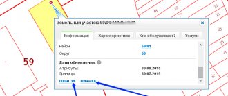
An explication of land is understood as a document that contains not only the plan of the area itself with detailed boundaries, but also explanations for it - symbols, numerical indicators, tables. Why explication is needed and where to go to get it done is discussed below.
Essence and purpose
The concept applies not only to land plots, but also to all other immovable objects - for example, apartments, houses, cottages, industrial premises, etc. The word “explication” itself means “clarification” - i.e.
The document contains a diagram of the land, symbols, as well as boundaries and quantitative indicators of the area: total, area of residential, outbuildings, etc.
Thus, by concept we mean 2 objects at once:
- procedure for drawing up a plan, measuring, describing a land plot;
- document of the same name.
It may be needed in cases where a certain operation is performed on the area:
- privatization from municipal or federal authorities;
- sale;
- exchange;
- donation;
- registration of lease, including long-term;
- entry into inheritance by law or by will.
The document is presented on an equal basis with others in cases where we are talking about a change in the owner of the plot. The registration procedure is carried out at the local branch of Rosreestr.
At its core, the paper is almost completely identical to the technical and cadastral passport. However, execution of an explication is still necessary for real estate transactions.
Sample explication 2020
The document consists of 2 parts:
- The actual plan of the land with symbols and outlines of all boundaries.
- Quantitative description of the parameters of the site - total area, area of buildings, etc.
Typically the diagram shows:
- boundaries of the land plot;
- the exact address of its location (must completely coincide with what is indicated in the certificate of ownership, cadastral passport and other documents);
- layout of objects on it;
- symbols (fences, buildings, industrial facilities, infrastructure);
- measurement of each side of the border and scale;
- the value of the total area, as well as the areas of each object located on the site.
The date of registration, the signature of the responsible person who carried out the measurements, as well as the signature of the head of the BTI and the seal of the organization must be included.
Procedure: step-by-step instructions
The procedure itself is carried out by specialists from the local BTI branch. To measure the site, a specialist must visit the area.
Typically, the measurement of the territory is carried out by installing so-called boundary markers - special pegs that are installed at each turning point.
As a result, the owner (or his representative) signs an act of acceptance of the work done.
In general, the sequence of actions looks like this:
- The applicant collects a package of necessary documents and calls a specialist.
- The specialist carries out all necessary actions on site.
- The owner accepts his work and signs the necessary documents.
- After some time, the applicant is given a corresponding document, which bears the same name.
To carry out the procedure, you will need the following documents:
- passport;
- an application, the form of which is issued by the BTI;
- land ownership certificate;
- the document on the basis of which the ownership right arose - in most cases this is a purchase and sale agreement, but it can also be a will, a gift agreement, etc.;
- a receipt confirming payment of the state duty.
Sometimes you will additionally need an order from the local Administration on the need to carry out explication - for example, if such a procedure is carried out in a planned and centralized manner.
Judicial orders may also be needed to approve the boundaries of the site. For example, if at some point the boundaries became the subject of litigation between neighbors, court orders must also be provided.
Dates for production and validity of the document
The document production period is 10 working days from the date of application.
If the site is located far away, this period can be extended by several more weeks, depending on how quickly a specialist can arrive on site and carry out all the necessary work.
The explication is valid for 3 years - after this time a new document must be issued.
If there is a need to quickly carry out work, you can contact private companies that have the right to carry out such activities. The document will be ready within 2-3 days. It has exactly the same legal force as that issued by the BTI.
Both the owner of the site and his representative can contact the BTI: for minors, these are parents or guardians. You can also apply through your representative, for whom a notarized power of attorney is issued.
link:
Loading…
Source: https://2ann.ru/chto-takoe-eksplikaciya-zemelnogo-uchastka/
What is and what does an explication of premises look like?
Explication of premises is a document that is necessary for inventories, organizing space; it contains data in the form of tables describing the number of floors, rooms in the room, number, functional purpose, data on height, area.
Depending on the functional purpose of the room, it may include additional information.
It must be present with the documents on the layout of the premises. This document clearly describes and deciphers all the symbols shown in the drawings, including all the necessary characteristics:
- gas supply;
- wall material and thickness;
- heating;
- sewerage.
- roofs;
- floors;
- water supply;
- electrical wiring device;
Most often it is created in the form of a table. Sometimes the table is attached as a separate document.
As a rule, it comes complete with a floor plan.
Shape and size of the explication table (click to enlarge) An explication of the premises is necessary in cases where it is necessary to document the independent redevelopment and alteration of the premises carried out by the owner.
It will also be needed in cases of transactions: for sale, mortgage, pledge, purchase, exchange of apartments. For a successful transaction, it is necessary to collect the entire package of documentation, which accurately indicates the area and layout of the premises.
This information is displayed. It is important that the data coincide with the real situation.
If redevelopment has been carried out, this must be included in the technical passport and legalized (You can find out how to obtain a technical passport for an apartment).
Layout and explication of the premises It is also necessary for cadastral registration of an apartment building. In cases of obtaining a mortgage, any bank will request a technical passport, a plan of each floor and an explication of the premises.
Click to enlarge image This document contains:
- purpose for examining the premises.
- data on the area of each individual room, as well as the total area of the room;
- type of room, its functional purpose;
- date of last verification of the explication;
- the exact address where the premises are located, cadastral number (you can read how to find out the cadastral number by address);
Please note: this document is drawn up after BTI employees have measured the object and entered the readings into the original version. When compiling an explication, they use the regulatory document GOST 21.501-93 SPDS Rules for the implementation of documentation of architectural and structural solutions.
Sample explication document for an apartment (click to enlarge) When buying and selling an apartment, an explication is made that shows the exact dimensions of the entire room, the area of each room, corridor, kitchen and even balcony, as well as the location of the gas stove and entrance. It indicates the area, both general and specific.
What is explication of a land plot?
An explication of land is understood as a document that contains not only the plan of the area itself with detailed boundaries, but also explanations for it - symbols, numerical indicators, tables. Why explication is needed and where to go to get it done is discussed below.
The concept applies not only to land plots, but also to all other immovable objects - for example, apartments, houses, cottages, industrial premises, etc. The word “explication” itself means “clarification” - i.e.
The document contains a diagram of the land, symbols, as well as boundaries and quantitative indicators of the area: total, area of residential, outbuildings, etc.
Thus, by concept we mean 2 objects at once:
- procedure for drawing up a plan, measuring, describing a land plot;
- document of the same name.
It may be needed in cases where a certain operation is performed on the area:
- privatization from municipal or federal authorities;
- sale;
- exchange;
- donation;
- registration of lease, including long-term;
- entry into inheritance by law or by will.
The document is presented on an equal basis with others in cases where we are talking about a change in the owner of the plot. The registration procedure is carried out at the local branch of Rosreestr.
Sample explication 2020
The document consists of 2 parts:
- The actual plan of the land with symbols and outlines of all boundaries.
- Quantitative description of the parameters of the site - total area, area of buildings, etc.
Typically the diagram shows:
- boundaries of the land plot;
- the exact address of its location (must completely coincide with what is indicated in the certificate of ownership, cadastral passport and other documents);
- layout of objects on it;
- symbols (fences, buildings, industrial facilities, infrastructure);
- measurement of each side of the border and scale;
- the value of the total area, as well as the areas of each object located on the site.
The date of registration, the signature of the responsible person who carried out the measurements, as well as the signature of the head of the BTI and the seal of the organization must be included.
Explication of a land plot - what is it - Malina Group
Housing law > Real estate registration > Land registration > Explication of a land plot - what is it and why is it needed
Today, bureaucratic subtleties are relevant for absolutely any sphere of life. In particular, real estate ownership was no exception. It's no secret that it is simply impossible to sell, buy or inherit real estate without drawing up accompanying documentation.
While many citizens of the Russian Federation are familiar with the technical passport of the same land plot, few have heard of such a document as land explication. Having received several requests from readers, our resource simply could not ignore the consideration of the explication of the land plot, as a result of which we present to you today’s article.
The material describes in detail the essence of such documentation, its purpose and content, which will be useful for many land owners to consider.
What is explication?
Explication is a word that came into modern languages from Latin. It meant equally “interpretation” and “explanation.” Today this word has acquired a very wide field of meaning and is used in a variety of fields, from science to jurisprudence.
In our case, an explication is an explanatory document that should explain the details of a large architectural project, such as abbreviations or numeric notations that are understandable only to layout developers.
By learning new things, you expand your capabilities and also reduce the likelihood of possible mistakes. This works fully here.
For example, without explication, according to current legislation, it is impossible to take ownership of real estate. As a matter of fact, the construction of the buildings themselves is stopped at the planning stage, if explication tables are not attached to the drawings.
As mentioned above, an explication, in architecture and property law, is a document. More precisely, this is an application to much larger-scale documentation, such as drawings of apartments, houses and multi-story buildings. This also includes site plans, floor plans, drawings of offices, enterprises and other similar premises.
The essence of the explication of premises is that specialists create a table that helps to understand the architectural plan. So any person, looking at the explanation, will be able to understand whether the room is intended for something or another.
In addition to information about the location of the explicit premises, which includes the address, number of floors and a specific floor and apartment number (office, auditorium, room, etc.), technical parameters are entered there, such as:
- Room area;
- Room height;
- Purpose of the premises;
Moreover, it does not matter at all whether this place exists today - the rules for design do not change, and all information must also be indicated.
The table can also be complicated by additional parameters. There are quite a lot of them and there is no need to get hung up on it, just say that the need depends on the purpose and type of property.
The need for explication of premises is due to its functionality, like, in fact, any other document. However, the table itself cannot be called particularly functional.
Therefore, to reveal its capabilities, you will need a floor plan.
These papers together make it possible, albeit not for any person, but for a specialist, to indicate with a certain accuracy the purpose of the property, as well as its advantages and disadvantages.
For the average person, an explication is nothing more than a piece of paper. However, architects and construction companies know its value. The fact is that it is absolutely impossible to obtain permission to erect a building or put it into operation without this “piece of paper”.
It is also important for contractors that when constructing multi-storey buildings, an explication is needed to register the building with the cadastral register. This does not apply throughout the entire territory of Russia, however, some subjects of the state require complete documentation, thus greatly complicating the registration procedure.
Individuals who are in no way connected with construction, architecture, and especially with the registration of constructed real estate may know about the explication as a list of premises.
Today this document is critical due to the widespread use of mortgage lending. Thus, the bank simply refuses to issue a mortgage to a client who does not have a technical passport with an explication of the apartment.
For offices and companies, explication is one of the eternal bureaucratic nightmares - technical inventory of premises. Explication is precisely the result of such checks, and therefore is valued quite highly.
Explication plan
The explication plan is the above-mentioned combination of a floor plan and an inventory table of the premises.
The most common plans are explications for the commissioning of apartment buildings and the subsequent sale of apartments in them. Both documents are necessary, since the first one shows the layout of the apartments, which is quite blurry for the inexperienced eye. The interior spaces that interest buyers and lenders are not shown there. This is why we need an explication of the premises.