Purpose concept
All existing land is divided into categories according to the state land use strategy. During the assessment, the quality of land, its fertility, the presence of vegetation, and soil composition are identified and recorded. At the same time, some territories are under state protection because they are valuable for science and ecology.
Thus, if the land belongs to the category established by the state, the regime of exploitation prescribed by law must be observed. The concept of the category of land, as well as their intended purpose, is identical, therefore both designations are used. To combine the main categories of land use, a special classifier was created.
Land categories
The Land Code of the Russian Federation establishes 7 categorical groups of lands, the main criterion of which is possible activity. Among them are:
- settlements (intended for the formation of settlements);
- agricultural plots;
- special - energy and industrial facilities are usually built on them, communications are carried out and measures are organized for
- ensuring state security;
- natural areas protected by authorities;
- forest lands;
- water fund;
- spare territories.
For development, plots are selected that fall under the category “settled areas.”
The latter category combines land unclaimed by citizens and legal entities. That is, if necessary, they can be used for all needs, and are usually not transferred to civilians. Some categories need to be considered in more detail, since not everything is so simple with them.
Lands of settlements
This category of sites was created for human habitation and placement of the corresponding infrastructure. It has certain boundaries that distinguish it from other lands. Thus, on such lands there may be multi-storey buildings or individual residential buildings, recreational areas used for recreation and tourism, as well as sports activities.
Industrial buildings and administrative facilities, public utility structures and institutions involved in supplying the population, both food and other, are also intended to be located in such areas. Also, the purpose of such lands can be:
- placement of power supply facilities;
- formation of transport infrastructure elements;
- carrying out communication connections, including communication facilities;
- opening, development of private household plots, etc.
The settlement is distinguished by the presence of a transport interchange, communications and power supply.
VRI does not in any way affect the possible forms of ownership, because in areas that require permanent residence of people, federal, private and municipal facilities may coexist. Individual buildings on land do not classify the entire territory as a residential area. It follows from this that even if there are houses and industrial premises on it (in remote enterprises, in forest areas and on farms), they cannot be considered part of a city or town until a decision is made to include the corresponding area in such a territory.
Agricultural land
The range of application is limited only to agricultural work, while the lands themselves must be located outside populated areas. Their main function is the production of agricultural products and the provision of activities that are necessary for this.
In total, the law establishes two subcategories: agricultural and non-agricultural land, and, despite the designated division, they all ensure the normal conduct of the corresponding production.
Agricultural land is located outside populated areas and is used only for its intended purpose.
Agricultural plots include those intended for agricultural activities or livestock raising. These are arable lands, as well as hayfields, pastures for livestock, areas with trees to protect crops from the wind and some other lands. Lands that have undergone the reclamation procedure are considered special. After all, in order for them to obtain the required properties, a number of measures were taken regarding drainage, restoration of fertility and other factors.
Non-agricultural land is intended mostly for auxiliary structures, including roads, reservoirs and other objects that help establish normal agricultural activities.
See also: The most popular plots for building a country house in the Moscow region.
Forest and water funds
If the land is officially classified as such a natural object, then its use for economic purposes is indeed permitted, but no more than what the categorical affiliation provides. Thus, in forest areas, forest management zoning is usually carried out, which consists of selecting areas for felling and restoration. After approval and division of zones, companies or individuals who have received permission have the right to cut wood.
Special permission is required to carry out any large-scale activities in the forest zone.
The water fund combines areas where there are artificial and natural reservoirs. Thanks to such lands, full-fledged water intake is organized, power plants and other structures are built to improve human life. As the law states, lands of the water fund usually cannot belong to a person, since water, like other natural values and subsoil, belongs to all citizens of Russia.
Changing the type of permitted use when transferring a land plot to another category
Land category is a part of the land fund, which includes land plots used in accordance with the intended purpose and permitted type of use established for them.
Accordingly, the transfer of lands or land plots from one category to another should be understood as a change in the intended purpose and type of permitted use of land plots as part of these lands, and by a change in the type of permitted use only the assignment of a land plot to another type of permitted use established for the same specific category lands.
The category of agricultural land includes lands (land plots) outside populated areas provided for agricultural needs, as well as intended for these purposes. These lands are allowed to be used for:
- conducting agricultural production, creating protective plantings, placing on-farm roads, buildings, structures, structures, communications used for the production, storage and primary processing of agricultural products;
- carrying out research, educational and other activities related to agricultural production;
- conducting by citizens a peasant (farm) economy, gardening, vegetable farming, livestock farming, haymaking and grazing;
- implementation by communities of indigenous peoples of the North, Siberia and the Far East of the Russian Federation of the traditional way of life, management and crafts.
The same category also takes into account the land redistribution fund, which is allowed to be provided for the listed purposes.
The category of lands of settlements includes lands (land plots) used and intended for the construction and development of urban and rural settlements and separated by the line of these settlements from other categories of land:
- residential areas (multi-storey and individual residential buildings, cultural and community facilities, areas for gardening and dacha farming);
- public and business zones (administrative buildings, educational, cultural and social facilities);
- production zones (industrial, municipal and warehouse facilities);
- zones of engineering and transport infrastructures (railway, road, river, sea, air and pipeline transport, communications and engineering infrastructure);
- recreational areas (urban forests, public gardens, parks, urban gardens, ponds, lakes, beaches);
- zones of agricultural use (arable land, hayfields, pastures, fallow lands, perennial plantings, buildings, structures, agricultural structures, areas for personal farming, gardening, vegetable gardening);
- special purpose zones (historical and cultural monuments);
- zones of military facilities.
The category of industrial and other special purpose lands includes lands (land plots) outside populated areas occupied by industrial facilities, quarries, energy facilities, automobile, sea, inland waterway, railway, air, pipeline transport, defense and security, communications, radio broadcasting facilities , television, computer science, support for space activities and other special purposes.
The category of lands of specially protected territories and objects includes lands (land plots) of state nature reserves, nature reserves, natural monuments, national parks, natural parks, botanical gardens, medical and recreational areas and resorts, water protection zones of rivers and reservoirs, prohibited and spawning protection zones , holiday homes, boarding houses, tourist centers, children's and sports camps, historical and cultural monuments, military and civil burial grounds.
The category of forest fund lands includes forest lands:
- lands covered with forest vegetation (forests), and not covered with it, but intended for its restoration (clearings, burnt areas, open areas, clearings);
- lands intended for forestry (clearings, roads, swamps).
The category of lands of the water fund includes lands occupied by water bodies, right of way and protection zones of water intakes, hydraulic engineering and water management structures and facilities.
The category of reserve lands includes lands that are in state or municipal ownership and are not provided to citizens and legal entities, i.e. their intended purpose is not defined.
Types of permitted use
The category of land is not the main way of expressing the scope of its use, because the permitted use of a land plot is simply a division of the territory located within certain boundaries. As a rule, based on the intended use, there is a division into three types:
- basic;
- conditionally permitted;
- auxiliary
Basic
These VRIs were introduced not so long ago in a modified classifier, and the following subtypes are combined under a common name:
- agricultural zones;
- used in the construction of houses (individual housing construction or designed for a large number of apartments);
- intended for the work of entrepreneurs;
- recreational (reserves, parks, etc.);
- production zones;
- creation of transport infrastructure;
- ensuring the security of the country;
- protected at the federal or regional levels;
- forest areas;
- water bodies;
- used by the public.
The division of plots according to purpose is quite wide
Why do we need a conditionally permitted type of land use?
Each property is assigned its own list of conditionally permitted uses. This is done in order to indicate a complete list of options for its operation.
The conditionally permitted type of use of the allotment allows or prohibits certain construction work on the construction of specific types of buildings.
In addition to this characteristic, the owner’s ability to choose an object is also influenced by the building regulations in force in the territory of a given city or region.
The lands of populated areas are intended for the organization of towns, cities and villages on their territory (Article 84 of the Land Code of Russia).
Their permitted use also depends on where the plots are located.
The legislation of the Russian Federation divides all lands into 8 zones:
- Residential buildings;
- Public and business development (shops, offices, sports facilities);
- Agriculture (gardening and vegetable gardening cooperatives, farms, summer cottages, etc.);
- Recreational area (forests, city parks, ponds, etc.);
- Territories that are valuable from the point of view of science, history, health, etc.;
- Special zones where cemeteries and landfills with household waste are located;
- Other lands allocated according to local conditions for the construction of permanent buildings and structures;
- Protected and military facilities.
The construction site where the construction of the building is being carried out is fenced in accordance with the requirements of the current land legislation.
Territories located under populated areas are divided into so-called functional zones. For them, the master plan establishes a certain framework for the structures being built.
Examples of restrictions:
- Functional affiliation of erected specific buildings within the boundaries of a city or village;
- Varieties of formations according to functions and plans, erected in a specific designated area;
- Other characteristics for the allocated zone, as well as the possibility of its further development (residential sector, industrial zone or recreational area).
Functional zones were created with the aim of dividing land under a settlement, depending on the type of its further use. The ultimate goal of this event is the rational use of the territory, taking into account the characteristics of the place and the interests of the residents.
Application of a section with a violation of the VRI
Since the lands are under state protection, users and owners must conduct their activities on them in accordance with the permitted directions. Thus, the concept of misuse of land is applied, which can include the exploitation of land in a way that is not intended by its category, or if the recommendations of the authorities are not fully implemented.
In addition, citizens and businesses using the sites must take care of them and prevent their condition from deteriorating. As a rule, this requires reclamation and other measures to improve the quality of the land. If a business entity does not comply with the requirements of the law, it will receive a fairly large fine as punishment.
To maintain its fertile properties, the land requires care
Procedure for changing category
The legislation allows the transfer of land from one category to another if there are grounds for this and the activity will not threaten the condition of the soil. To do this, you should prepare the following documents:
- identification document of the applicant (this can be any person legally owning or using the site);
- power of attorney (applied if the interests of the owner or user are represented by another person);
- consent of other owners certified by a notary, confirming the possibility of changes;
- cadastral documents, usually a technical passport and plan;
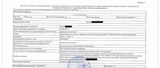
- an extract from the real estate register regarding the person who owns or uses the site and the main characteristics of the territory;
- a document proving the legality of ownership (this could be a lease agreement, a purchase and sale agreement, a deed of gift, inheritance documents, etc.);
- statement.
Having a basis for changing the category of a land plot and all the necessary documents will speed up the process
List of documents for the procedure
The owner of a land plot, first of all, should contact the local administration to clarify the issue of the existence of a resolution that will serve as the basis for changing the VRI. Then, you need to prepare the following list of documents.
- An application for changing the VRI completed by the owner to the local administration;
- general passport or any other identification document;
- if the land is owned by a legal entity, then an extract from the Unified State Register of Legal Entities is required;
- if the owner is represented by an authorized representative, then a copy of his passport and a notarized power of attorney with a list of his powers are submitted;
- an extract from the Unified State Register confirming ownership, which must indicate the main characteristics of the site and the document on the basis of which the land became the property of the owner;
- address or situational plan of the site, allowing you to determine its location and boundaries;
- if the land lessee submits an application, the consent of the lessor is required;
- for permanent structures located on the site, documents confirming their registration;
- planning project for the territory on which the site is located.
Features of combining plots
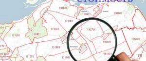
Often citizens own several separate plots of land, which can easily be combined with each other by following the appropriate procedure. But you need to take into account that they must have adjacent boundaries, being next to each other. Each unit must have a plan that specifies its boundaries, and it must also be registered in the cadastre as a separate plot.
In addition, land is subject to restrictions regarding the maximum area, and the location is subject to a requirement of one cadastral block. In addition, the same categorical affiliation will be required, and most importantly, the VRIs must also match. If there are several owners, they will also be required to agree to the action in the form of merging the plots.
A citizen will need the following documents:
- a statement describing the request to carry out the merger;
- cadastral papers confirming the official information of the site;
- extract from the state register of ownership;
- written consent of the owners to the procedure for combining land.
The whole procedure begins with the collection of the documentation described above, which is submitted to the cadastral engineer who is developing a plan for combining the territories. Next, the completed papers are sent to Rosreestr or transferred to MFC employees, where the state register is adjusted based on them, updated documents regarding ownership and amended cadastral documentation are generated.
Ways to change VRI
The issue of transferring agricultural land to settlement land, due to the lack of land for individual construction, is especially acute. In addition, the cost of these categories of land differs significantly.
Also, today the land legislation of the Russian Federation provides for the opportunity to build good permanent housing without worrying about the hassle of transferring land to another category.
There are 2 ways to obtain permission to build a large house on agricultural land, with the opportunity to obtain registration and permanently reside in it:
- N172-ФЗ (03.12.2004) – on transfer to another category.
- N191-FZ (December 29, 2004) – on the entry into force of the Civil Code of the Russian Federation.
Within one category
The second option is the most common, it is simpler, but it also has a certain procedure:
- The VRI of land can be changed based on the schemes for the development of the territory of the municipality, general plans of settlements, cities and urban planning regulations, subject to compliance with technical regulations.
- An application for changing the VRI is submitted to the self-government body.
- It is required to hold public hearings, where the participants will be citizens living within the territorial and adjacent zones.
- There is a requirement for mandatory publication of the results of these hearings.
- The hearing commission makes a conclusion and makes recommendations, on the basis of which the head of the local government makes the appropriate decision.
When transferring a site from one category to another
There is a specific list regulating the possibility of transferring from one category of land plot to another:
- Those that are in Federal ownership are decided by the Government of the Russian Federation.
- Owned by the constituent entities of the Russian Federation - by the government authority of a specific constituent entity of the Russian Federation.
- Agricultural land areas owned by municipalities are decided by the authority of the given subject of the Russian Federation.
- Lands of private owners / agricultural areas - the executive power of a specific subject of the Russian Federation.
- Lands for other purposes - by local government.
Briefly about the main thing
The state classifier of types of permitted use of land plots regulates what activities can be carried out by a person in specific territories. Work in a direction not intended for a specific site will be prosecuted by law, since this will disrupt the normal use of the land and reduce its value in the future.
For violation of land use rules, a fine may be imposed or even the rights to ownership or land use permit may be taken away, which can be carried out through the courts. The law stipulates the possibility of supplementing or changing the VRI upon application, to which a number of documents must be attached. Thus, without approvals, it is impossible to erect a residential building on an agricultural plot or start growing wheat on spare lands.
Use of land for other purposes may result in a fine
To determine whether it is possible to carry out certain actions on a land plot, you should check the VRI of the land plot using the unified state cadastre database. If the condition of the site deteriorates, penalties will be applied, since every land owner and land user is obliged to maintain its good condition.
A little more attention!
Write in the comments what you think – is it still possible to “get through” with unauthorized construction, or can you no longer deceive the state?
Ratings 0
Read later
Required documents
For the procedure for changing the type of permitted use of land, its owner must prepare a package of documents consisting of:
- from a statement, including descriptive, pleading and motivational parts;
- the applicant’s identity card, land title papers;
- extracts from the Unified State Register for the site;
- conclusions of the Main Department of Architecture and Urban Planning of the Moscow Region regarding restrictions on the turnover, formation and use of a land plot;
- receipts for payment of state fees.
Legal entities and individual entrepreneurs must additionally request from the Federal Tax Service and include in the documentation package extracts from the unified state registers of legal entities or individual entrepreneurs.
In a situation where the application is not submitted by the owner, the consent of the owner and a power of attorney for the representative will be required. Documents are accepted in person and by mail.


