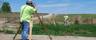
Guide to using a cadastral map
The public cadastral map is located on the Rosreestr website and provides information regarding all plots of land and other real estate and construction projects. The card is available to any citizen of the Russian Federation.
In order to use the service, you will need to go to the Rosreestr website and go to the “Public cadastral map” tab or indicate “cadastral map” in the search column of any browser. In the latter case, the system will give a result where the required service will be in first place.
The guide to finding vacant land on a map includes the following steps:
- Selecting a region for research. In the lower right corner of the map that opens there are plus and minus symbols for changing its size. By enlarging the image, you should select the region of interest to the user. You can also move the map by clicking and holding the mouse cursor.
- Study of the selected territory for the presence of vacant land plots. On the left side of the map menu you will need to select the “Manage Map” button. In the window that opens, go to the “Thematic maps” tab and check the box next to “Form of ownership of the land plot”.
- Selecting a free site. In order to see unoccupied territory, you will need to enlarge the map until demarcated zones appear on it. Privately owned plots of land will be colored pink. Free areas do not have any fill and are highlighted in white.
When studying the cadastral map, you must be patient, as in some cases the page takes quite a long time to load. It is recommended that you wait until the image and data are fully loaded before proceeding.
A thorough study of the issue does not always guarantee a positive outcome.
.
On our website you can
get the most detailed consultation on your issue from our lawyers
for free in Moscow (
+7-499-350-97-04) and
St. Petersburg (
+7-812-309-87 -91).
Take it into circulation
But in many regions, most of the land in and near populated areas is privately owned, which creates serious problems for local and regional authorities in the development of housing construction. As a rule, vacant areas are so-called “inconveniences” without roads or communications. Construction there is very expensive, and people don’t want to go there.
For cities with developed infrastructure, the solution to the problem could be development programs for built-up areas. This is practically the same thing as what is called renovation in Moscow. However, in the capital, a special law had to be passed to launch it. In the regions, the development of built-up areas is still going poorly: firstly, there are no investors, and secondly, there is no adequate regulatory framework. A lot of questions have not been resolved: how to include certain territories in the program, on what boundaries and grounds, what is the role of property owners, how to make decisions...
The State Duma is considering two documents with options for resolving these problems: the “Khovanskaya Law” (FZ-59 “On Amendments to Article 17 of the Housing Code of the Russian Federation”) and the draft of the Legislative Assembly of St. Petersburg. In addition, a bill on this issue is being prepared in the Federation Council Committee on the Federal Structure. But so far there is no concrete decision from the legislator.
For cities with developed infrastructure, the solution to the problem could be development programs for built-up areas
Therefore, unfortunately, where there is no free land, but some area in the center needs to be renovated, the only option is to recognize the houses as unsafe. Which sometimes leads to wild consequences. For example, in Tatarstan, many decent houses in Zelenodolsk, Almetyevsk and other cities are immediately recognized as unsafe. People resist and are indignant, but the authorities have no other way to get land. Although the development of built-up areas could become an important tool for urban renewal and solving housing problems. Moreover, the changes made to 85-FZ allow the Housing and Communal Services Reform Fund to co-finance projects for the development of built-up areas if citizens are being resettled from dilapidated housing. However, the projects themselves are not yet enough.
Developers are forced to buy plots at a fairly high price. If we still want to make housing more affordable, we need to provide for a reduction in the cost of land. One option is to sell according to the “Dutch auction” scheme: the one who offers the lowest price wins. Such competitions are held all over the world.
In Russia there is a huge amount of land that is taboo, including those associated with defense enterprises and other closed structures. A significant part of this territory is occupied by non-core facilities. In general, we essentially have a lot of plots for development, but we need a set of measures to consistently bring them into circulation.
What data can you find out using a map?
The cadastral map provides information regarding various real estate objects registered with Rosreestr. In order to view information regarding a specific area, you will need to select it with the left mouse button. Clicking will open a window with data about the plot of interest, where the status of the plot will be indicated in the “Form of ownership” field.
Additionally, the information window contains information:
- cadastral number and cadastral quarter;
- address information;
- land category;
- cadastral value;
- land area;
- date of registration.
It is important to clarify that the data included in the cadastral map is not always reliable. This is possible in the following situations:
- the plot is under registration to a new owner;
- new information about the territory has not yet been included in the cadastral map.
Additionally, you can check whether the site is occupied through the “Services” tab located in the information window. Here you will need to click the “Reference information on real estate objects online” button. On the newly opened page of the site, click the “Generate request” button. If the selected area is vacant, then, according to the data available in Rosreestr, the address of the object will not be determined.
In order to obtain the most reliable information, it is recommended to send a request for an extract from the Unified State Register of Real Estate in order to clarify whether the plot is in the process of being registered to a new owner. If the data is reliable and the allotment does not have an owner, you can safely submit an application to the administration with a request to acquire ownership or lease the selected territory.
A cadastral map is an indispensable attribute in the procedure for collecting information about various plots of land, which greatly facilitates the selection of territory according to the personal requirements of a citizen. After additional verification of the information received, the future landowner has the opportunity to submit an application to the administration authorities for the acquisition of the selected plot of property.
Today the trend is that people want to buy or rent plots for individual housing construction (IHC). Therefore, information about vacant lands is in great demand in society today.
Where and how to get it is of interest to many citizens. One of the most popular ways is to independently study the cadastral map.
Is it possible to
Today's IT technologies have simplified the procedure for searching for a free plot of land in the vastness of the Russian Federation. Just visit the Rosreestr website and refer to the Public Cadastral Map.
The user just has to master the program interface and find the area of interest.
If a citizen is interested in the availability of vacant land plots in a previously determined territory, then he is recommended to go to the website of the local administration.
It is possible that information about the formed plots that the administration has put up for auction for sale or rent has already been posted there.
You can personally contact the local administration with a request to issue a copy of the cadastral plan of the subordinate territory. It is advisable to obtain a copy at a scale of 1:500, as this is the most accurate document.
If you need a free plot within the city, then the Land Use and Development Rules, which contain an urban zoning map, will help you find it. You can find the Rules on the Internet by typing the corresponding phrase into a search engine.
Using the map, urban areas with free areas for housing construction are identified. The citizen will only have to study the information received and make a decision.
To independently search for the desired free plot of land, you can also use:
- Google satellite map;
- online service “How to find out the owner of real estate.”
What is it for
An independent search for a free plot of land is usually initiated by a citizen in a certain situation when the information from the local administration does not suit him on some issues.
For example, having received from the administration a cadastral map of the territory of interest and having become familiar with it, a citizen did not find an area of interest to him.
That is, there is a need to search for a territory in which either there is already an option for a land plot that is interesting for a citizen, or there is an opportunity to form it according to one’s interests.
One of the reasons for independently searching for free land for individual housing construction is the high cost of the plot being sold or leased to the local administration.
It's no secret that almost all land areas put up for auction are valued at cadastral value, which is usually several times higher than the market value.
An independent search for land will provide a person with much more freedom in obtaining the desired result.
This is especially convenient when a person needs a site that meets certain requirements: area, configuration, location (forest, river, etc.), availability of production, transport and social infrastructure.
Thanks to the public cadastral map of Rosreestr, today this has become possible. With its help, a Internet user can form the desired area by drawing its future boundaries.
By marking the boundaries of the future site on the cadastral map, the user immediately receives information about its area, perimeter length, and coordinates.
After this, a screenshot of this part of the cadastral map with the generated plot of land is taken, which is subsequently provided to the Administration to decide on the acquisition of this plot as ownership or lease to the applicant.
How to view vacant plots of land using a cadastral map
As a general rule, the surveying of vacant lands and their cadastral registration is the function of local governments. However, the land surveying procedure requires the participation of cadastral engineers, whose services are not cheap. For this reason, almost the entire mass of land in municipal ownership does not have definite boundaries. This will help you decide in which zone to start searching, based on the purposes for which the site is needed. Thus, private individuals can only claim land for individual housing construction or agricultural land. Other categories cannot be transferred to private ownership. They can only be rented.
22 Dec 2020 marketur 143
Share this post
- Related Posts
- Who is included in a small business when paying preferential insurance premiums to the pension fund in 2020
- Rent a house with subsequent purchase
- 40 years of experience and what benefits are provided St. Petersburg
- I bought a house in Ufa, how tax breaks apply if in Khabarovsk
How to find an unoccupied land plot for individual housing construction on a cadastral map
A public cadastral map is a modern popular tool used by Internet users to search for vacant land for housing construction. The map is on the Rosreestr website.
To find the desired area on the map, perform the following steps:
- an area for research is selected. By enlarging the map image and clicking on the map, the Russian territory of interest is marked;
- the selected area is examined for the availability of available land. To do this, open “Map Management” in the menu and then “Thematic Maps”. Flag o. After this, you should enlarge the map until the cadastral plots appear on it. The territory that is owned by someone will be painted pink.
Now it’s the turn to explore the free territory, since its white color does not mean that it is truly free.
It is possible that this area is marked in white for the following reasons:
- not all information about the territory has been included on the cadastral map;
- plots are at the stage of registering someone's ownership of them, and so on.
The area of interest is selected on the map and information about its status begins to be collected: whether it is really free from development, whether it is owned or leased by someone else.
To get more detailed information about a site, by clicking on its image on the map, the “Plots” drop-down window is called up, where all information on the object is stored:
- cadastral number of the land plot itself;
- number of the cadastral block that includes the area of interest;
- status;
- category;
- cadastral value;
- square.
You should pay attention to the information in the “Land Category” box.
If you do not find out which category the plot in question belongs to, it may turn out that it is not intended for housing construction, but, for example, for farming. That is, you can build farms and household buildings, but not a residential building.
This information can be found in the Land Use and Development Rules and from the urban planning plan.
The area is also checked through “. Information on real estate objects registered in Rosreestr is stored here. In the window that opens on the Rosreestr website, information about the plot of land of interest will appear.
A request is being generated. If the site is free of real estate, then the window that opens will indicate that, according to the State Real Estate Cadastre (GKN), the address of the site has not been determined.
By clicking on “Address not determined”, you can find out a more detailed history of the site: whether it was owned by someone, the date of registration in the Cadastral Chamber, the date the information was updated, etc.
After this, you should create a request to the State Property Committee in the same window. This step will make it possible to establish that the site is not being registered by someone else, and that this procedure may have already been approved for someone else.
If the response from the State Property Committee confirms the previously received information, then you can safely submit an application to the Administration for the provision of the surveyed site for rent or ownership.
For greater confidence, you can submit a request to the Unified State Register of Rights (USRE). The response from the Unified State Register must confirm that the site in question is not owned by anyone.
In the end, it won’t be superfluous to view satellite maps from Yandex or Google. By enlarging them to the required scale, you can visually verify that there are in fact no structures or real estate objects on the land plot in question.
By the way, here you can determine the distance to some objects (city center, village, highway, railway station, etc.).
All the actions described above are done before applying to the Administration of a municipality or city with an application for the provision of land for ownership or lease.
Methods for finding vacant lots on a public cadastral map
All free territories are highlighted in yellow. If only part of the address was entered, then several objects will appear in the list of search answers. All that remains is to choose the appropriate one and also study it in detail. Among the land data, it will be possible to see the individual memory number. In the future, it will be possible to contact this person and agree on the purchase and sale of the territory. This method of obtaining information is also convenient because, in addition to general data, it will be possible to formalize and send an official request to obtain information from the State Property Committee or the Unified State Register. To do this, you will need to go to the “Services” tab in the memory card and select the desired section.
Please note => Sample notice of salary change upward
What is the price
If a citizen independently found vacant land on a public cadastral map and formed a plot at his own discretion, then drawing up his cadastral plan will be a rather difficult and costly procedure.
Since the land surveying project for a new site requires approval, in order to approve it, you need a diagram of the location of the site on the cadastral plan of the municipality or city. This work is carried out by cadastral authority engineers, of course, not for free.
The cost of their services varies. True, the legislation gives the constituent entities of the Russian Federation the right to limit the cost of land surveying by cadastral specialists, but this is not always done.
If the upper limit for the cost of cadastral engineer services is not limited by government structures, then it can range from two to ten thousand rubles. It all depends on the site, area and region. The restrictions imply a much smaller, two to three times, amount.
If we talk about online services when searching for a free plot of land, then each online request to the State Real Estate Cadastre costs 200 rubles.
Considering that the required plot usually cannot be immediately found on the public cadastral map, the number of such requests can be quite large, as well as the amount spent on obtaining online certificates.
Video: How to find a vacant land plot on a cadastral map
Among my friends, there was not a single one who would refuse to find free land , draw up a plot of land for and register everything legally with the local administration.
Many city residents want to acquire a plot of land, but few have a clear idea of how to practically obtain land.
In this article, I will briefly talk about the tools that help me personally find vacant land and draw up land schemes for subsequent acquisition without bidding.
To obtain a plot of land you need to do 2 (two) simple steps:
Search for a vacant land plot on a public cadastral map
On March 1, 2020, land reform will take place, according to which the municipality can be forced to put the land up for auction. This is quite interesting to me. I found information that Medvedev ordered that information about vacant lands be made publicly available by February 1, 2014. If I understand correctly, then you need to look for vacant land on the public cadastral map https://maps.rosreestr.ru/PortalOnline/ But my question about finding vacant land relates to unformed land plots. And auctions for land plots will be published for already formed land plots. But I want to form a plot on “free land” myself. If I understand correctly, changes in land law on March 1, 2020 make it possible to form a land plot yourself by preparing the relevant documents. Medvedev promised that from February 2014 it will be possible to get public access to “free land”. And my main question is how to get information about free land? Very similar, this opportunity is provided by the public cadastral map of Rosreestr, from which you can find “white” undemarcated plots. But it’s confusing that these “white” areas are not always free - apparently not all the information ends up on this map (or the map has not been updated for a long time).
Please note => What subsidy is a pensioner entitled to pay for utilities?
Draw up a layout diagram of the land plot.
It is possible to run around the area and look for free land to build a house or personal subsidiary plot, but it is very tiring.
At the same time, it is not a fact that the found land plot has not already been occupied by someone. In this case, you need to start the “running” again from the beginning.
And if you live in the North and want to move for permanent residence to warmer climes, for example, to the Krasnodar Territory, then searching for free land on the ground is even more difficult for you, because you don’t have to fly by plane to find a free plot every time.
In this case, it is wise to use a remote search for a free plot of land.
With the help of free online services, anyone can find vacant land plots.
For example, using the Public Cadastral Map and satellite maps from Google and Yandex, you can view almost any area of the earth’s surface in the area of interest with an accuracy of several meters.
And the simple ability to obtain the Rules for land use and development of any settlement allows you to specifically search for land plots only in those zones in which you can build a house, start a personal subsidiary plot or a dacha.
Okay, we found a free plot of land. What to do next?
The next step is to draw up a layout diagram of the land plot.
The land plot plan is the first and main document that is necessary to receive land from the administration.
If the administration approves the Land Plot Scheme, then you receive this plot of land without any auctions. Review of the Land Plot Scheme is carried out by the administration within 30 days.
To draw up a land plot plan, most people invite a cadastral engineer.
A cadastral engineer, for 10,000 - 20,000 rubles (different in each region), draws a diagram of the land plot.
Many people order a land plot plan from a cadastral engineer because they do not know what
You can draw up a diagram of a land plot yourself in 40 minutes, no worse than a cadastral engineer.
You do not need to have any special education, licenses or certificates.
It took me about 40 minutes to complete my first Land Plot Scheme. However, I am not a cadastral engineer.
Now drawing up a map of any plot of land takes me no more than 10 minutes.
Why is it wise to draw up a plot of land yourself, rather than pay a cadastral engineer?
Because the mere preparation of a Land Plot Scheme by a cadastral engineer does not guarantee that you will receive this particular plot.
For example, you hired a good cadastral engineer, spent money on drawing up a map of the site, but as a result, other characters may begin to lay claim to the site, and the administration will put the land up for auction.
In this case, you will be silently declared public gratitude for spending money on a cadastral engineer. But no one will return the money.
It is better to make a land plot diagram yourself, because this allows you to launch procedures for obtaining several land plots at once, and this increases the chances of obtaining land.
After going through all the procedures for obtaining a land plot, when you already have confirmation in your hands that the plot will be provided only to you, then you can safely hire a cadastral engineer to carry out land surveying and register your land plot with cadastral registration.
Until the administration has given you an official guarantee in the form of an approved Land Plot Scheme, it is pointless to spend money on a cadastral engineer.
How can you learn to find vacant land and draw up a site plan?
Step-by-step video instructions helped me move from stupid thoughts to practical steps to obtain a plot of land.
These video instructions show in detail (using specific examples) the entire algorithm of actions, which anyone can easily repeat.
Watching the video instructions and performing step-by-step actions, I realized that the “extreme difficulty” that realtors and cadastral engineers had been telling me about for so long was just a cunning trick of pseudo-specialists, accustomed to profiting from the ignorance of ordinary citizens.
Why is it wise to start obtaining a plot of land with Step-by-step video instructions?
There are actually many advantages, but I will give you the 5 main ones that I have tested from personal experience.
Searching for available land remotely expands your land acquisition opportunities because you can look into beautiful areas that many people didn't even know existed.
All you need is a computer, Internet access and the desire to get a plot of land.
Of course, you will need to spend time even remotely searching for free land, but it is worth it.
Find vacant land only in those areas that, by type of permitted use, correspond to your goals: individual housing construction, private plots, summer cottage, vegetable garden, etc.
There is a lot of free land in Russian cities and towns, especially in quiet corners.
However, not every plot of land can be used, for example, for the construction of an individual house, or for personal farming.
Land in different places has different purposes, or so-called different types of permitted use.
Step-by-step video instructions will help you find suitable land plots because you will be able to read and understand the Urban Zoning Map.
The ability to find and correctly use an urban zoning map is a valuable skill that is not possessed by amateurs who look for vacant plots like blind kittens, poking at luck, and, as a rule, at random.
Remotely receive information from Rosreestr about all land plots in any cadastral quarter.
The most current information about land plots is contained not in the computer of an administration official, but in Rosreestr.
I talked to many government officials, but not one of them told me that there was free land in his area.
But you have absolutely no need to trust the empty words of officials, because you can easily obtain a cadastral plan of the territory of any cadastral quarter from Rosreestr, and in 5 minutes find potentially free undemarcated lands.
Draw up a Land Plot Plan yourself.
How does the process of drawing up a diagram work?
Everything is quite simple: you download the free program, upload the file you received from Rosreestr into it, and set 4 points on the territory you like.
Then, in the same program, in 2 clicks, load a raster background so that forests, meadows, fields and infrastructure around your site are displayed on your diagram.
Next, the program itself calculates the area of the land plot that you have formed, and also determines the coordinates of the turning points.
After this, all you have to do is copy and paste the drawing and the coordinates of the points into the document template, which is included in the Step-by-step video instructions.
The scheme is ready.
Some people pay 15,000 rubles to draw up such a diagram and wait 2–3 weeks for it to be completed.
You can make a plot of land for free in 40 minutes.
Ready-made document templates that need to be submitted to the administration for preliminary approval of the provision of a land plot.
Ready-made templates are included with step-by-step video instructions:
application for preliminary approval of the provision of a land plot,
Layout of the land plot.
It is enough to fill in your full name and other data and documents to receive a land plot.
After this, you send the completed documents to the administration and note the time. The administration must respond no later than 30 days.
You can watch video fragments to make sure that the Step-by-Step Video Instructions are truly valuable material.